Jordan in photos

Such a cool place in the Middle East. Famous for Petra, the Dead Sea, and the desert vibes of Wadi Rum. Amazing mix of history and landscapes!

Bedouins are nomadic Arab tribes who traditionally lived in the deserts of the Middle East, known for their hospitality, resilience, and deep connection to the land.

The Bedouins know the Wadi Rum desert, which covers about 720 km², like the back of their hand. They told me they recognize the paths across the desert, and at night they navigate by the stars.

Their food is simple but full of flavor. One of the most famous dishes is zarb, meat and vegetables cooked in an underground oven. Too bad I didn’t take a photo, but they showed us how it’s done. Evenings with them by the campfire were amazing, they were so honest when we asked questions.

Getting to Kościeliska Valle in Tatra Mountains by public bus from Zakopane with timetable (May 2025)

  Kościeliska Valle is one of the most beautiful valleys in Poland. Located around Tatra Mountains, on a Polish side of the range, creates an absolutely amazing and breath-taking trial. It is one of the most popular family walks while visiting close by Zakopane, as the whole path up to Ornak Hall (Hala Ornak-Schronisko) is flat and easy done even by a small children. Walk from the entrance right up to hall, even with breaks, wont take longer than 2 hours each way. There are also 4 caves on the way to add, but you have to allow extra time for it, as some of them are located 1h of walk away from the main road of the valley, some just 25 mins. This place is definitely a must see and can be extended to a proper hike trial, if you will carry on after Ornak Hall. More or less, even that the entrance to the park is located 20 mins ride from the center of Zakopane, you do not need to take a taxi. Bus is the best and cheapest option. Some can even get to Kiry, for Kasprowy Wierch cable card, with one of the numerous mini buses operating in the area along with a public PKS bus. The ticket cost just 3zl (less than 1$) each way, and is paid to the bus driver only by cash. There are two main bus stops in Zakopane. One is at the main Bus Station and the other one at the beginning of Krupowki Street, main street in Zakopane. Both places got a signs pointing the bus stop, in polish called Dolina Kościeliska or Kościelisko. Please see the map attached for bus stop near Krupowki street.


Zakopane – Kościeliska Valle

And here is a timetable, but please be at the stop 10-15 mins before, as the bus is always early and never waits!! Welcome to Poland 🙂

Bus Line 52 Schedule Route: Zakopane – Kościeliska Valley (via Skibówki, Krzeptówki)

Departures from Zakopane:

  • Zakopane PKP Station (St. 2): 08:05, 09:05, 09:35, 10:05, 11:45, 13:30, 13:50, 14:40, 15:40, 16:50.
  • Zakopane, Aleja 3-Maja (Lower): 08:07, 09:07, 09:37, 10:07, 11:47, 13:32, 13:52, 14:42, 15:42, 16:52.
  • Zakopane, Targowica: 08:09, 09:09, 09:39, 10:09, 11:49, 13:34, 13:54, 14:44, 15:44, 16:54.
  • Zakopane, Strug: 08:10, 09:10, 09:40, 10:10, 11:50, 13:35, 13:55, 14:45, 15:45, 16:55.
  • Skibówki I: 08:11, 09:11, 09:41, 10:11, 11:51, 13:36, 13:56, 14:46, 15:46, 16:56.
  • Skibówki II: 08:13, 09:13, 09:43, 10:13, 11:53, 13:38, 13:58, 14:48, 15:48, 16:58.
  • Krzeptówki: 08:15, 09:15, 09:45, 10:15, 11:55, 13:40, 14:00, 14:50, 15:50, 17:00.
  • Gronik: 08:17, 09:17, 09:47, 10:17, 11:57, 13:42, 14:02, 14:52, 15:52, 17:02.
  • Nędzówka: 08:19, 09:19, 09:49, 10:19, 11:59, 13:44, 14:04, 14:54, 15:54, 17:04.
  • Kościelisko UG: 08:20, 09:20, 09:50, 10:20, 12:00, 13:45, 14:05, 14:55, 15:55, 17:05.
  • Kościeliska Valley: 08:21, 09:21, 09:51, 10:21, 12:01, 13:46, 14:06, 14:56, 15:56, 17:06.

Departures from Kościeliska Valley:

  • Kościeliska Valley: 08:30, 09:30, 09:55, 10:30, 12:15, 13:50, 14:15, 15:15, 16:15, 17:15.
  • Kościelisko UG: 08:31, 09:31, 09:56, 10:31, 12:16, 13:21, 14:16, 15:16, 16:16, 17:16.
  • Nędzówka: 08:32, 09:32, 09:57, 10:32, 12:17, 13:52, 14:17, 15:17, 16:17, 17:17.
  • Gronik: 08:34, 09:34, 09:59, 10:34, 12:19, 13:54, 14:19, 15:19, 16:19, 17:19.
  • Krzeptówki: 08:36, 09:36, 10:01, 10:36, 12:21, 13:56, 14:21, 15:21, 16:21, 17:21.
  • Skibówki II: 08:38, 09:38, 10:03, 10:38, 12:23, 13:58, 14:23, 15:23, 16:23, 17:23.
  • Skibówki I: 08:40, 09:40, 10:05, 10:40, 12:25, 14:00, 14:25, 15:25, 16:25, 17:25.
  • Zakopane, Strug: 08:41, 09:41, 10:06, 10:41, 12:26, 14:01, 14:26, 15:26, 16:26, 17:26.
  • Zakopane, Targowica: 08:42, 09:42, 10:07, 10:42, 12:27, 14:02, 14:27, 15:27, 16:27, 17:27.
  • Zakopane, Równia Krupowa: 08:44, 09:44, 10:09, 10:44, 12:29, 14:04, 14:29, 15:29, 16:29, 17:29.
  • Zakopane PKP Station (St. 8): 08:46, 09:46, 10:11, 10:46, 12:31, 14:06, 14:31, 15:31, 16:31, 17:31.

Note: The “G” mark indicates buses running only from July 1 to September 30, as well as during May holidays. The line is not operational on All Saints’ Day.


Here is the schedule for Bus Line 53 from Zakopane to Kościeliska Valley via Wojdyłówka:
Departures from Zakopane:
  • Zakopane PKP Station (St. 2): 08:35, 09:15, 09:45, 10:45, 11:15, 11:55, 12:25, 13:05, 13:45, 14:55, 15:50, 16:30.
  • Zakopane, Aleja 3-Maja (Lower): 08:37, 09:17, 09:47, 10:47, 11:17, 11:57, 12:27, 13:07, 13:47, 14:57, 15:52, 16:32.
  • Zakopane, Górka: 08:40, 09:20, 09:50, 10:50, 11:20, 12:00, 12:30, 13:10, 13:50, 15:00, 15:55, 16:35.
  • Zakopane, Szymaszkowa: 08:41, 09:21, 09:51, 10:51, 11:21, 12:01, 12:31, 13:11, 13:51, 15:01, 15:56, 16:36.
  • Zakopane, Czajki: 08:42, 09:22, 09:52, 10:52, 11:22, 12:02, 12:32, 13:12, 13:52, 15:02, 15:57, 16:37.
  • Kościelisko, Sobiczkowa: 08:43, 09:23, 09:53, 10:53, 11:23, 12:03, 12:33, 13:13, 13:53, 15:03, 15:58, 16:38.
  • Kościelisko, Karpielówka: 08:44, 09:24, 09:54, 10:54, 11:24, 12:04, 12:34, 13:14, 13:54, 15:04, 15:59, 16:39.
  • Kościelisko, WDW Kościelisko: 08:45, 09:25, 09:55, 10:55, 11:25, 12:05, 12:35, 13:15, 13:55, 15:05, 16:00, 16:40.
  • Kościelisko, Wojdyłówka: 08:46, 09:26, 09:56, 10:56, 11:26, 12:06, 12:36, 13:16, 13:56, 15:06, 16:01, 16:41.
  • Kościelisko, Ośrodek Zdrowia: 08:47, 09:27, 09:57, 10:57, 11:27, 12:07, 12:37, 13:17, 13:57, 15:07, 16:02, 16:42.
  • Kościelisko, Szeligówka: 08:48, 09:28, 09:58, 10:58, 11:28, 12:08, 12:38, 13:18, 13:58, 15:08, 16:03, 16:43.
  • Kościelisko, Chotarz Polany: 08:49, 09:29, 09:59, 10:59, 11:29, 12:09, 12:39, 13:19, 13:59, 15:09, 16:04, 16:44.
  • Kościelisko, Chotarz Hajduk: 08:50, 09:30, 10:00, 11:00, 11:30, 12:10, 12:40, 13:20, 14:00, 15:10, 16:05, 16:45.
  • Kościelisko, Nędzówka: 08:51, 09:31, 10:01, 11:01, 11:31, 12:11, 12:41, 13:21, 14:01, 15:11, 16:06, 16:46.
  • Kościelisko, Urząd Gminy: 08:52, 09:32, 10:02, 11:02, 11:32, 12:12, 12:42, 13:22, 14:02, 15:12, 16:07, 16:47.
  • Kościeliska Valley: 08:53, 09:33, 10:03, 11:03, 11:33, 12:13, 12:43, 13:23, 14:03, 15:13, 16:08, 16:48.
Here is the return schedule for Bus Line 53 from Kościeliska Valley to Zakopane:
Departures from Kościeliska Valley:
  • Kościeliska Valley: 08:55, 09:35, 10:05, 11:05, 11:40, 12:25, 13:10, 14:00, 14:25, 15:25, 16:25, 17:25.
  • Kościelisko, Urząd Gminy: 08:56, 09:36, 10:06, 11:06, 11:41, 12:26, 13:11, 14:01, 14:26, 15:26, 16:26, 17:26.
  • Kościelisko, Nędzówka: 08:57, 09:37, 10:07, 11:07, 11:42, 12:27, 13:12, 14:02, 14:27, 15:27, 16:27, 17:27.
  • Kościelisko, Chotarz Hajduk: 08:58, 09:38, 10:08, 11:08, 11:43, 12:28, 13:13, 14:03, 14:28, 15:28, 16:28, 17:28.
  • Kościelisko, Chotarz Polany: 08:59, 09:39, 10:09, 11:09, 11:44, 12:29, 13:14, 14:04, 14:29, 15:29, 16:29, 17:29.
  • Kościelisko, Szeligówka: 09:00, 09:40, 10:10, 11:10, 11:45, 12:30, 13:15, 14:05, 14:30, 15:30, 16:30, 17:30.
  • Kościelisko, Ośrodek Zdrowia: 09:01, 09:41, 10:11, 11:11, 11:46, 12:31, 13:16, 14:06, 14:31, 15:31, 16:31, 17:31.
  • Kościelisko, Wojdyłówka: 09:02, 09:42, 10:12, 11:12, 11:47, 12:32, 13:17, 14:07, 14:32, 15:32, 16:32, 17:32.
  • Kościelisko, WDW Kościelisko: 09:03, 09:43, 10:13, 11:13, 11:48, 12:33, 13:18, 14:08, 14:33, 15:33, 16:33, 17:33.
  • Kościelisko, Karpielówka: 09:04, 09:44, 10:14, 11:14, 11:49, 12:34, 13:19, 14:09, 14:34, 15:34, 16:34, 17:34.
  • Kościelisko, Sobiczkowa: 09:05, 09:45, 10:15, 11:15, 11:50, 12:35, 13:20, 14:10, 14:35, 15:35, 16:35, 17:35.
  • Zakopane, Czajki: 09:06, 09:46, 10:16, 11:16, 11:51, 12:36, 13:21, 14:11, 14:36, 15:36, 16:36, 17:36.
  • Zakopane, Szymaszkowa: 09:07, 09:47, 10:17, 11:17, 11:52, 12:37, 13:22, 14:12, 14:37, 15:37, 16:37, 17:37.
  • Zakopane, Górka: 09:08, 09:48, 10:18, 11:18, 11:53, 12:38, 13:23, 14:13, 14:38, 15:38, 16:38, 17:38.
  • Zakopane, Równia Krupowa: 09:11, 09:51, 10:21, 11:21, 11:56, 12:41, 13:25, 14:16, 14:41, 15:41, 16:41, 17:41.
  • Zakopane PKP Station (St. 8): 09:13, 09:53, 10:23, 11:23, 11:58, 12:43, 13:28, 14:18, 14:43, 15:43, 16:43, 17:43.

Here is the schedule for Bus Line 54 from Zakopane to Kościeliska Valley via Wojdyłówka and Chotarz:
Departures from Zakopane:
  • Zakopane PKP Station (St. 2): 07:35, 08:55, 10:15, 11:35, 13:25, 14:20, 15:35, 16:45, 18:10, 19:25, 20:30, 21:30.
  • Zakopane, Aleja 3-Maja (Lower): 07:37, 08:57, 10:17, 11:37, 13:27, 14:22, 15:37, 16:47, 18:12, 19:27, 20:32, 21:32.
  • Zakopane, Górka (Wiadukt): 07:40, 09:00, 10:20, 11:40, 13:30, 14:25, 15:40, 16:50, 18:15, 19:30, 20:35, 21:35.
  • Zakopane, Szymaszkowa: 07:41, 09:01, 10:21, 11:41, 13:31, 14:26, 15:41, 16:51, 18:16, 19:31, 20:36, 21:36.
  • Zakopane, Czajki: 07:42, 09:02, 10:22, 11:42, 13:32, 14:27, 15:42, 16:52, 18:17, 19:32, 20:37, 21:37.
  • Kościelisko, Sobiczkowa: 07:43, 09:03, 10:23, 11:43, 13:33, 14:28, 15:43, 16:53, 18:18, 19:33, 20:38, 21:38.
  • Kościelisko, Karpielówka: 07:44, 09:04, 10:24, 11:44, 13:34, 14:29, 15:44, 16:54, 18:19, 19:34, 20:39, 21:39.
  • Kościelisko, WDW: 07:45, 09:05, 10:25, 11:45, 13:35, 14:30, 15:45, 16:55, 18:20, 19:35, 20:40, 21:40.
  • Kościelisko, Wojdyłówka: 07:46, 09:06, 10:26, 11:46, 13:36, 14:31, 15:46, 16:56, 18:21, 19:36, 20:41, 21:41.
  • Kościelisko, Ośrodek Zdrowia: 07:47, 09:07, 10:27, 11:47, 13:37, 14:32, 15:47, 16:57, 18:22, 19:37, 20:42, 21:42.
  • Kościelisko, Szeligówka: 07:48, 09:08, 10:28, 11:48, 13:38, 14:33, 15:48, 16:58, 18:23, 19:38, 20:43, 21:43.
  • Kościelisko, Chotarz Polany: 07:49, 09:09, 10:29, 11:49, 13:39, 14:34, 15:49, 16:59, 18:24, 19:39, 20:44, 21:44.
  • Kościelisko, Chotarz Hajduk: 07:50, 09:10, 10:30, 11:50, 13:40, 14:35, 15:50, 17:00, 18:25, 19:40, 20:45, 21:45.
  • Kościelisko, Nędzówka: 07:51, 09:11, 10:31, 11:51, 13:41, 14:36, 15:51, 17:01, 18:26, 19:41, 20:46, 21:46.
  • Kościelisko, Urząd Gminy: 07:52, 09:12, 10:32, 11:52, 13:42, 14:37, 15:52, 17:02, 18:27, 19:42, 20:47, 21:47.
  • Kościeliska Valley: 07:53, 09:13, 10:33, 11:53, 13:43, 14:38, 15:53, 17:03, 18:28, 19:43, 20:48, 21:48.
Return Departures from Kościeliska Valley:
    • Kościeliska Valley: 07:08, 08:05, 09:25, 10:55, 12:05, 13:50, 14:50, 16:00, 17:15, 18:50, 19:55, 20:55.
    • Kościelisko, Urząd Gminy: 07:09, 08:06, 09:26, 10:56, 12:06, 13:51, 14:51, 16:01, 17:16, 18:51, 19:56, 20:56.
    • Kościelisko, Nędzówka: 07:10, 08:07, 09:27, 10:57, 12:07, 13:52, 14:52, 16:02, 17:17, 18:52, 19:57, 20:57.
    • Kościelisko, Chotarz Hajduk: 07:11, 08:08, 09:28, 10:58, 12:08, 13:53, 14:53, 16:03, 17:18, 18:53, 19:58, 20:58.
    • Kościelisko, Chotarz Polany: 07:12, 08:09, 09:29, 10:59, 12:09, 13:54, 14:54, 16:04, 17:19, 18:54, 19:59, 20:59.
    • Kościelisko, Szeligówka: 07:13, 08:10, 09:30, 11:00, 12:10, 13:55, 14:55, 16:05, 17:20, 18:55, 20:00, 21:00.
    • Kościelisko, Ośrodek Zdrowia: 07:14, 08:11, 09:31, 11:01, 12:11, 13:56, 14:56, 16:06, 17:21, 18:56, 20:01, 21:01.
    • Kościelisko, Wojdyłówka: 07:15, 08:12, 09:32, 11:02, 12:12, 13:57, 14:57, 16:07, 17:22, 18:57, 20:02, 21:02.
    • Kościelisko, WDW: 07:16, 08:13, 09:33, 11:03, 12:13, 13:58, 14:58, 16:08, 17:23, 18:58, 20:03, 21:03.
    • Kościelisko, Karpielówka: 07:17, 08:14, 09:34, 11:04, 12:14, 13:59, 14:59, 16:09, 17:24, 18:59, 20:04, 21:04.
    • Kościelisko, Sobiczkowa: 07:18, 08:15, 09:35, 11:05, 12:15, 14:00, 15:00, 16:10, 17:25, 19:00, 20:05, 21:05.
    • Zakopane, Czajki: 07:

Kościeliska Valle-Zakopane

Return bus stop from Kościeliska Valley offers loads of options towards Zakopane, almost every 15-20 minutes in high season time. Just please don’t be later than 18.00 – 19.00 to be sure to catch one. Thought, they run till 21.00, I suggest to take earlier one anyway. See up for timetable for 52, 53 and 54. They all stop in few places in Zakopane (near main street Krupowki, finishing usually near main bus station). The bus stop is located just outside of the entrance to the park (to the left, when leaving the valley)

Visual trip around Tatra Mountains

Year has pass, and yet, no new trips, no new photos. Luckily, still got many memories from the past. Here, just some of the captures from a very cool trip I did with just my niece and nephew to the south of Poland. Zakopane offers many easy and beautiful trials around lakes, to and from the tops of mountains, around valleys and more. This makes this place as a great option to visit with young ones.

Extra shot of adrenaline at the Dead Road in Bolivia

Name “Dead Road” definitely does not come in a first place to any mind as a casual attraction. Originally named Yungas Road became well-known as a silent killer of thousands. Famous for being most dangerous road in the world that contributed to many deaths of drivers in the past and some cyclists in recent years. All as a result of how and where the road has been constructed. A combination of a single track road, 900m high cliffs, rainy weather, limited visibility, rockfalls, waterfalls and lack of guardrails participated in all death. Luckily, and finally, Yungas road was modernised to include two driving lanes, asphalt pavement, drainage systems and guardrails. New road has been opened in 2009, as an alternative of a must choice, replacing the dangerous 64 km stretch. All traffic being diverted to the new road. I am really glad motorists can now travel from La Paz to Coroico without fearing the journey may be their last. New road, apart from the fact that has already saved hundreds of life, left Bolivia also with one of the coolest, adrenaline giving and very adventurous tourist attraction in this country. People from all around the world visit this part of Bolivia to cycle down trough the original way. I did too.ddfdfdfd

Some statistics to give you the idea

“200 to 300 estimated death drivers yearly along Yungas Road and as late as 1994 there were cars falling over the edge at a rate of one every two weeks.”

“One of Bolivia’s most tragic road accidents happened on July 24th 1983 when an overcrowded bus veered off the side of the road and into a canyon killing more than 100 passengers.”

“Even with these improved conditions, Yungas Road shows no mercy. Nowadays, the death toll is limited to local workers and daredevil backpackers still using the infamous road. It is believed that more than 22 cyclists have lost their lives on Bolivia’s “Death Road” since 1998.”20160202_101011

To do or not to do

The answer for me is definitely YES TO DO. I wasn’t thinking even for a minute whether I should do it or not. It was surely one of the coolest thing I did in South America. However, it really is not for everyone. Most agencies will not be very honest with you, as they just want loads of people to sign for it for the profit. There is no limit of age, fitness etc, but since I have done it, I can set some average requirements. Here they are:

  • Dead Road is suitable for confident cyclists to, of course, experts. A bit higher than average fitness and above. In particular for everyone aged 16 and more, but mostly done by younger group of people, usually at the age gap of 20-30. I did have two people at the age of 50-60 in my group. They both were fit and did well. Having said that, our group was one of the fastest, starting last, finishing first, so I am sure it can be done by not perfectly fit people, but maybe get some advice on best company to go with, if that’s the case for you.
  • Most of the road is very stony and dusty. The whole road is 64 km long, and, thought, you mostly going downhill, you have to be a good cyclist with some experience to keep up with the group.
  • You have to be very very careful, you need a perfect eyesight. The whole road is mostly thin and going via many waterfalls. Mentioning good eyesight meant to warn you that at the beginning road is extremely foggy, and it is difficult to navigate. Waterfalls are very tricky, as the group do not stop to pass them, you will go trough them at your max speed.20160202_122240
  • Keep in your mind that it is pretty much “fast and furious” activity. You do not have a choice, but just go at max speed, well…at least my group was fast. So think twice if you want to do this. Trust me, I felt on my head, destroying the helmet, having an open wound on my left elbow, that got swollen as well. Yet, I still had 30 kilometers to go….gosh that was painful. Another guy broke his leg too.
  • Cycling will last 5 hours, at high performance. Road is approximate downhill: 90% (one section contains a few small uphills). You have to be ready for sore hands.
  • The drop in altitude means travelers experience both chilly conditions in the Altiplano highlands and hot humid conditions in the rain-forests below. Your body needs to be ready for it. Highly not recommended for people, that already feeling light-headed at the high of 2000m.

Once the answer is yes

  • Even that you will be provided with food and water, take an extra bottle with you. You will start in very cold environment, but once half way trough, you will be surrounded by tropical hot weather, and that`s the time when your body will need some extra hydration, so you will drink loads at the end.
  • Take a good waterproof jacket, as is usually raining near the top.
  • As the temperature will be going up, proportionally to the distance cycled downhill, have something under to wear after, preferably with long sleeve, unless you will be provided with elbow protection.20160202_094517
  • Take maybe old cloths. I thrown away my shoes after.
  • Have some wet tissues, your face will be constantly covered with mud.
  • Lucky you if you own GoPro, you can record the whole way by attaching your camera to the bike or helmet. Few of my group-mated done it.
  • Do not book you trip if you just landed in La Paz. You body needs few day to adapt to the altitude. Yungas Road climbs to around 4,650 meters, from where you will start.
  • Check the weather for the next day. No worries, you can book a trip just one day before, even before 17.00 pm. The bottom line is not to rain that day!
  • Have a phone in your pocket. Thought you will have just quick breaks, you will have few chances to take some photos of this absolutely outstanding landscape and scenery.
  • Remember! 21 cyclists and 5 guides have died since the road had been opened for mountain bike trips. It might not be the most dangerous road in the world anymore, but it is still the Death Road. Don`t be to cocky on the road.
  • Most likely your agency will not cover the entrance fee for riding a bike. it is 50 Bs now – 25 Bs at the start and 25 Bs at the end of the road.
  • You really should be covered with medical insurance for this!

Prices and booking

Dead Road is usually done from La Paz, the city in Bolivia. There are loads of agencies to provide you with their service, especially around city center area. Every single hostel and most hotels can book you in too. It really isn’t a problem to buy this trip. It is relatively cheap. Prices depend on agency and mostly the kind of the bike, you will be provided with. It will be between 50-100$, as of 2016. I rented the worst bike, and I think being cheap about the bicycle is not the best idea. Get a double suspension one and from a good agency. Never go with Luna Tours agency (see photos above to recognise uniform and logo). I went with them and was promised to be provided with photos and movies of us while cycling. They did film a lot, took loads of photos, and at the end agency provided us with CDs where all media suppose to be. After few moths, when I came back home exited to show movies to my sister and her kids (to show how cool is their aunt), I discovered that there is no photos or movies of us!!!  Just old movies to promote agency. I was extremely disappointed and angry, I have only few photos from my phone. DSC_0830.jpg

Brief overlook of the day trip to do the Dead Road

  • My meeting point was at the cafe in La Paz at 7.00 am where we had a breakfast, and we briefly discussed the plan for the next 10 hours. Please note that some agencies can pick you from the hotel.fdf.jpg
  • At 8.00 am our bikes got uploaded to the top of the van, we sat in, and we went off from La Paz, which is at a height of 3,600 meters (11,810 feet), to the foot of the Andes Mountains towards the summit, which was at 4,700 m.
  • Approx at 10.00 am we arrived at the starting point of La Cumbre Pass. We then proceed to get the specialized equipment for each of us. The guides make recognition of our teams. We were also explained of all the rules at the road, how to sign with your hand, and what our schedule will be.
  • We were fitted into our gear that was: a jacket, pants with knee pads to put under, gloves, and a full-face helmet. Then we tested our mountain bikes: breaks and sit high. Our guide rechecked all again to make sure all is safe, and we went off.
  • Starting the adventure at around 11.00 am.
  • First 20 kilometers is via new asphalt road to Coroico. Actual Dead Road will start after that length. In this bit we can get used to the bikes and enjoy the road before difficult part.
  • Quick break for a snack before getting in to actual Yungas Road.
  • Dirt road begins at a height of 2,700 meters (2,953 feet) above sea level. In the beginning of the Bolivian jungle. Exactly where the paved road ends begins the most dangerous road in the world.
  • Keep cycling through rivers, waterfalls, along with the wide variety of beautiful flora and fauna with few breaks to keep the team together.
  • At 15.00 finishing and arriving at the bridge, congratulating each other. At the end of the road, you will get a well deserved beer or coke and a t-shirt. I picked coke…hmmm, I must have being still in shock after my fall :D.
  • After a little rest heading off for a well deserved dinner with swimming pool on the side and showers to refresh.
  • At approx 16.30-17.00 heading back to La Paz, arriving at around 18.30-19.00.

Finding some peace in Pokhara

 Arriving, even trough a tiny roads between Himalayas and wild rivers, from a busy streets of Kathmandu to a calm and peaceful Pokhara almost seemed like a way to nirvana for me. You can find there everything that`s missing from the capital. Not overcrowded streets are surrounded by a beautiful mountain range with deadly Annapurna looking at you from every single corner, yet seems like she gives your mind a great piece of a rest.

  Pokhara is located 200 kilometers west of the capital. Could be a surprising fact to learn that by occupying the area of 464.24 km2 this city stands as larger than Kathmandu, 18 times larger than Lalitpur and 2.5 times larger than Bharatpur. Because of its popularity and it​s touristic nature, as of many available activities to choose from, this area is packed with hotels, hostel, restaurants, travel agencies, and anything visitors really need. It’s well known mostly as a gateway to the Annapurna Circuit, a popular trail in the Himalayas to hike. However, when it comes to the city, it is not only about the highest mountain range in the world. Pokhara`s landscape consist of a beautiful and the second largest lake of Nepal, called Phewa, with clear green waters that is an absolutely stunning thing to enjoy. On a sunny day when the sky is clear, you can even see surrounded range as a reflection on a smooth surface of the lake. Inviting waters, apart from being the main resource for fishing, offers load of activities from kayaking to just lazy ride on the boat through the lake. Or how about just simple walk around where you can sit and enjoy in one of restaurants, coffee shop or a smoothie making stands. That could be an option as well, wouldn`t it? This seems like a popular thing to do, as there are always loads of tourists along with locals around the shore too.

Cycling around the area, even up to the top of the Sarangkot, seems like a very popular activity. Alternatively, you can hire a scooter or motorbike to discover the area a bit further and see more lakes, as name “Pokhara” means the valley of the lakes itself (derived from “Pokhari” which literally means a lake). There are eight of them in total. Apart from the most popular inside the valley, previously mentioned Phewa, others are: Begnas, Rupa, Maidi, Khaste, Gunde, Dipang and Kamal Pokhari. Phewa, Begnas and Rupa are definitely three lakes worth visiting. Apart from beautiful calm surface of them, surely is wort experiencing a wilder nature of waters as rivers and waterfalls, which Pokara is famous for. The Seti River is much popular among the tourists. It runs through deep channels in the conglomerate rocks from Bagar to Sita Paila, and in some places it flows through the narrow gorge. Going through by the river sides below the hills, we can see several beautiful and dashing waters falling downhill and finally flowing to the rivers. You can even enjoy them just by passing the highway to Baglung that consist few of them on the way. The city itself also has a beautiful waterfall, and it is known as Davis Fall (In Nepali: Patale chango).

It truly is a breath-taking experience just looking at the Davis Fall in ChorrepatanThe water flowing in this fall comes from Fewa lake, and the fall is worth visiting during the rainy seasons as it possesses its maximum velocity. But lets not get stuck there for too long, there is way more to see around. Absolutely magnificent cave is just two minutes walk from there. Basically the whole Pokhara valley is rich in cave system, and it almost seems like a vision of a city hidden under the ground. Mahendra Cave, for example, is located in the city of Pokhara and can be easily accessed by the visitors in just walking distance (few kilometers), taxi ride or just by public buses. It is named after the late king Mahendra Bir Bikram Shah Dev. The cave itself is amazing and you can witness many natural shapes and images of the various Hindu gods and goddesses on the stone made of the lime. Literally just a ten minutes walk from this cave there lies another one named the Bat Cave. In Nepali language it is also called Chameri Gufa. You can guess correctly who residence inside, the name suggests it well. It is called after the habitats of the bats over the cave’s wall and the ceilings. Above all caves you can find a dense forest with a stream flows, ending as a sparkling waterfall tumbling into a mysteriously hidden world of darkness. In total Pokhara is renowned for ten mystical caves. Nevertheless, right now, only nine of the caves can be visited as the Eastern Power Station cave has been badly damaged and buried, as it is under a huge landslide, leaving its beauty only for few lucky one.

  Near by Sarangkot hill is a must hike place as well. It is very popular to cycle or just walk all the way up, however, bus, taxi and scooter is an option too. Once there, you can enjoy absolutely outstanding panorama of the surrounded valley underneath and the magnificent view of the mountains. In to the northern direction we can see Dhaulagiri in the far west. Annapurna range is visible when the weather is clear on the same side. On the southern direction the village overlooks the city of Pokhara and its lake on the north-western outskirts of the city. Sarangkot is only 5 km from lake side, Pokhara, and is the highest view-point for a sunrise at just 1592 m high, but the temperature drops already 5 degrees cooler than the city. The hill can be done easily by 45 minutes car ride to the top from Pokhara and then 45 minutes hike up to the main view-point. Many tourists come to Sarangkot for sunrise view and go back after few hours, but it will be good if you will get a chance to stay there for one night and enjoy the way city light outshine from there. Paragliding is a very popular activity that can be done from that area too. You can book that at one of many agents in Pokhara, or one at the top. 

Paragliding is a good way to start with when it comes to more adventurous side of this area. The city offers everything from ultralight flying, skydiving and ziplining to a bungee jumping, developing a complete holiday package for a perfect vacation to all kind of tourists. But there is a last, but not least, thing worth mentioning. Remember to also visit the old side of the city where you will be able to experience and feel cultural side of Nepal along with all old temples, statues and buildings around. Old Town is a real treat for the people who love to discover a new place from its roots and history. Best explored on foot, Old Town in Pokhara offers an unmatched view of the new parts of the city in the morning, before the traffic and daily chores take over the landscape. Once there, you will come across a marketplace selling locally produced items; Bhimsen Temple, an old shrine dedicated to the Newari god of trade and commerce with Bindhya Basini Temple, dedicated to goddess Durga. You can find a good range of delicious street food as well. Its is a place to observe locals on a daily life too, getting on their daily routine. Thought, not so overcrowded as Kathmandu, you will meet loads of Nepalese to chat to, talk to. You wont be disappointed with the way they will interact towards you.

  At the end I would like to mention that I arrived to Pokhara from Kathmandu, where I was during the earthquake. I spend 48 hours at the ground, sleepless, wet, tired. I did not only found a peace, but a shelter. I felt safe there, as aftershocks were hardly noticeable, and the whole city did not get damaged as a capital. It will always stay as a very special place for me. But for you guys, I think it enough to know that it is a magical, adventurous place you just can not miss while in Nepal!

Best cycling routes around Atacama from San Pedro

  Cute little village, called San Pedro de Atacama, lies on a high plateau of Andes in the northern part of Chile. The area around creates the most outstanding landscape on the planet that includes deserts, volcanoes, geysers, hot springs and salt flats found only in this part of the world. Surroundings make the scenery around San Pedro to be worth seeing at least once in your life. Together with Easter Islands and Patagonia, stands as the top place to visit once in Chile. The area is known to be one of the driest places in the world which leads to the fact that there’s not much green around, yet the unique geology structure creates there something so beautiful that is beyond anything, anything I saw so far. Not even mentioning that you can also easily see a magnificent milk way at night too.

 Small town San Pedro, with population just under 4,000, tends to be a very popular destination, so it`s packed with hotels, hostels, restaurants, shops and anything travelers need really. Please be aware that beds are always in high demand, so you really have to book your stay in advance. I did not know about it, and I had to stay longer in Santiago to spend my new year there, not in San Pedro as planned. It happened because all was already booked up. I got there on 3.01.2016, and it was still full of tourists. Once you’re lucky claiming your accommodation, go to look around. Village is very small and feels very cosy. Whoever decided to name the streets wasn’t really in his clear mind, so you can get lost very easily at first, but after some time you will know your way around well. In the center you can have a good meal or just a nice coffee. You can buy some clothes, hats or a tasty local alcoholic drink, called pisco (actually Peruvians are a bit angry, as this drink has been made first by them…or so they say). The prices around main street are not so high, but clearly set for tourists. I have found a very cool little area to eat, in far east that travelers don’t know about (you’re welcome). Meals there cost around 4$, are very local and very tasty. There are a few small restaurants (if you can call it like that) next to each other, and every single one got something different to offer. There`s one internet cafe in the center too, if you needed, and broadband is really not as bad as backpackers complain about! Apart from that, main street is loaded with tourist agencies. You can book loads of amazing trips there at a very affordable price. Please note that you need some spare Chilean pesos with you, as there is always something extra to pay on your trip (usually entrance fee). It’s good to book few. However, for me, the highlight of my stay turns to be cycling around Atacama Desert. Except for 3 days tour I took around all lagoons, geysers and salars, but that was on Bolivian side, so I will write about it in section about that country.

  Cycling. You can hire a bike literally on every corner in San Pedro. They are in a very good condition, and you are getting an extra gear with them too (spare tube, helmet, pump and map). Prices are not so high, and they do depend on length of time you are planning to rent your bike for, and the quality of your vehicle. You can hire it from an hour up to 48 hours. Loads of hotels do this service too, which makes it easy to return it and just to go straight to your room after. I used one agency to rent and once my hotel, and prices were very similar. As far as I remember, it was around 6-8$ for the whole day. So, as I mentioned, you will be given a map with routes you can do. It really is easy to find your way around, but please keep your map with you, as you wont be meeting loads of people on the way to ask for directions. Take also loads of water with you. It’s a very hot area, and climate is extremely dry. Stuck up on some snacks too, shops are only in San Pedro! The field is elevated, so better to use sunglasses and sun protection cream. Now…AGAIN! I have lost all my photos from this beautiful place. I realized that while writing this blog. I was devastated, and I almost cried. I really captured such an amazing moments, areas, friends, and I took really great photos! This place is so so special for me. I have only few from my phone left. It is the same situation, I have had with my photos from Mexico and Belize when 2/3 of my pics just disappeared from my SD card, just like that. Did anyone got the same problem? Can I fix it? I still got all my SDs, and they are full, so photos are there, somehow. Help me readers, you’re my only hope!

Routs

  • Valley of the Moon

   Valley of the Moon, or Valle de la Luna, as a part of the Salt Mountain range, is one of the most visited places in San Pedro area.

The name, probably, came from the fact that the place really looks like from different planet. The whole plateau does! The valley is accessible from the town by car or bike. It is only 10 kilometers away, and you will get there via main road. There are loads of signs on the way pointing directions towards valley, so you will easily find your way. You could walk too, but the whole area of the valley is quiet large already, so you might get tired a bit. The valley also got a spot where you can do a sun-boarding. The entrance fee is just 3,000 Chilean pesos, that’s around 4.5$. The ground around is so dry that there are no any living creatures. So again, remember to take plenty of water with you. Well, as far as I remember, there is a little shop by the entrance too, in case you will run out of drinks. With your ticket you will get a map with all highlights on it, so even with no guide you wont miss anything. I don’t even want to start here how things are looking around there, because I know I already use word “amazing” way to often here. Basically, you will see few beautiful canyons, sandy desert, unusually structured rock formations, snow looks-like a ground (minerals under the soil are responsible for the white cover) and caves. Here, I have to say that after the earthquake in Nepal, I was a bit scared to go trough that tiny little dark caves, but I got over the fear while half way trough there. With the tour, you will end your trip watching the sunset over the amazing valley. So, as you know by now, I did book my tour to see the valley, but I also got there one day on a rented bike. Two ways of doing so got pluses. With tour you will go with a nice group and a tour guy. He will take you in some caves too. But while cycling there alone, you will be very flexible.

You will stop anywhere you like, and you will lose loads of calories, as there are loads of hills to climb. The big minus is that after the sunset its dark, and you will have to cycle back like that. The climate, like geological structure, is diverse too, so as soon as the sun is gone, it`s getting very very cold very very quickly. To be honest, sunset over the valley is something you can’t  miss. Well, anyway, you will decide! I guess it is worth doing it twice in both ways, if you have a spare time there. Why not to see the magnificent scenery twice.

  • Devils Throat

 Devils Throat is the name of a cycling path around another stunning valley. The entrance is just little bit further from Pukara de Quitor, on a right hand side. The trial is 18 kilometers long, so with the road back it`s 36. Every company, you will hire your bike from, will give you the map with the road on it. It is a very easy and pleasant path, a bit rocky at times, but mostly flat. Just in few places you will face some hills, but they are not so high at all. The land around is a bit green, with the little river that will accompany you trough the whole trail. You can see some houses on your way (watch out for angry guarding dogs :).

It really is amazing that people lives in such a peaceful and remote area. Just to warn you, that there will be no phone signal, so cycle carefully please. I did this trial with my lovely friend, I’ve  met on the top of Pukara de Quitor, Dorit. So anyway, because I was not alone, we let ourselves a bit, and we went way further than the Devils Throat trial. We crossed the river three times, holding our bikes in hands, and we got, probably, where not many tourists go. And really, again, watch your way around. I still have a big scar on my knee as a souvenir from there 😀 The whole experience was amazing, and the hills around your way will make you breathless. Me and my friend both had shoes and pants wet, but who cares. The area is so dry, nothing stays wet for too long. Dryer is definitely not needed for locals there.

  • Pukará de Quitor    

  So what stands behind this funny name? An archaeological site just north of the town. It is so close (3 km from San Pedro) that you can easily do it with Devils Throat in one day. The side is looking interesting even without the ruins. But they do add the ancient vibe to the area. It`s known that it has been structured by precolombian Atacameño people as a fortress against Inca people. The road there is very straight forward, and even I remember it by now, a year after. Just cross the river on the north-east area, to take the road along the bank of the stream. Then after some time, you should already see the signs pointing the direction. The entrance to the park is very affordable at just 3,000 CLP. You can find there also a small museum with some artifacts that have been found in the area, and a brief view of the history of the place and people who lived there and created it. There is also a place to lock your bike. The ruins are all over the little hill, you will hike. To be honest, it is not so spectacular as rest of the valley, but you can learn loads of interesting facts by reading all the descriptions. Once you’re done with it, please hike a bigger hill just next to it. At the top you will find a mirador (viewpoint), that will give you the opportunity to look at beautiful valley beneath. The road to the top, again, is not difficult, takes around 30 minutes, and its build of rocky steps. At the top you can find a little structure and some faces sculpted in the rock. They look pretty cool. When your eyes feel satisfy with the surrounded view, you can start heading back to San Pedro for a tasty lunch to satisfy your stomach now :p

Few days in vibrant Kathmandu

   It’s amazing how well I always knew what kind of areas in the world I would like to see in the future. Nepal was on my list as a very first country to visit since I was very young. Something was always telling me that it is probably one of the most fascinating and astonishing places in the world. What I wasn’t sure about was the wonder, if I will ever be able to go there. Fortunately, I did get a chance to visit this truly diverse land with the highest mountain range in the world. I wasn’t mistaken at all, as I found there everything, I always imagine I would find. Even that I was in Kathmandu during the earthquake didn’t change my experience in any way. I witness how Nepalese truly helped each other during and after the disaster. For this, and loads of other reasons, I consider Nepal as a small Asian country with the big-hearted people.

Landing in Kathmandu and getting around

  When it comes to the international airport, it is probably one of the oldest and smallest I’ve ever seen, but then the size makes it easier to find your way around. I arrived in April from not so warm Europe, so the heat struck me straight away. After 2 hours in the long queue to get a visa, I was finally able to see the other side. I picked my bag from the floor somewhere, and I left happy and glad it didn’t get missing. Stepping outside, I quickly spotted how overcrowded and chaotic this city is. This helped me to make a quick decision on not trying to work out how buses run, but just to take a taxi. The situation on the road can be really shocking for someone who has never been in Southeast Asia before. The jam, noise, unclear driving rules and no traffic lights makes you wonder how on earth Nepalese getting around on a daily basis there. The car or motorbike can drive everywhere where it fits, even through a tiny tiny streets, so better have your eyes around your head. Watch out also for what locals transport on their motorbikes or bikes, as It can be something four times of a vehicle size, so be aware of the situation around you to avoid being knock down by something. I wouldn’t recommend walking while listening to your music either to avoid any accidents. I would definitely suggest to get your accommodation in Thamel. It is the most touristic area in Kathmandu. I am always trying to stay away from this kind of places, but there is just way different. You can meet loads of amazing backpackers, trekkers, travelers and volunteers to talk to, to share your experience with. Locals are very friendly too, so you definitely won’t get bored or lonely there. Shops and restaurants are on every possible corner, but always have cash with you. It’s very unlikely to pay by card, maybe just in posh hotels and restaurants. Also if you will see a cash machine, use it. There’s not so many of them around. Some of them may not work and some may not accept your card. I’ve had a Visa and MasterCard, and I wasn’t always able to use the first one, but with the second I’ve had a better luck. 

Food

  Try to sample as many new things as you can. For me everything was very delicious and packed with wonderful flavors. It is a heaven for Asian cousin lovers, like myself. People who sell meals on the streets really mastered their cooking skills. They make it very local, very unique, always fresh, and usually made in front of you. I have to add that I’ve met few travelers that complained about experiencing some stomach problems after, but not me. So maybe try to find a golden line between cleanliness and vibe of authentic local street food. Momo`s are definitely must eat there. They are very traditional and you can have them with many different fillings and sauces.

I am from Poland, and they do remind me of our dish called pierogi. I wonder if that’s how they came to us through the Russia first.  Apart from them, rice and noodles are probably most popular. It’s like a fusion of Indian and Chinese food. They all come in good vegetarian range too. If you like a late meal you will get even a better choice, as loads of street stands are open only in the evening. It’s good to have a supper around that time, as you will meet loads of travelers around. The only problem there is lack of the streets light, so visibility depends only on shops and restaurants neons. It could be a problem sometimes, as often on some streets, I’ve had to walk in total darkness….alone…brrr.

Transport

  If there are loads of things you want to see in one day, hire a motorbike. It really is very cheap, around 10£ for a day, and can save you loads of time. You can get a bike too, but it can be difficult to ride it on all these small streets full of people. Otherwise, not much for me to say about public buses in capital, as I haven’t used it at all, relying just on my private transport – my legs. However, three main bus station are present with buses that connect cities and towns in Nepal. All a little bit chaotic, but by keep asking, you should eventually find the one you need. No worries if you will take a wrong one, everything is worth seeing in Nepal :D. More or less, Nepalese are good with English and always happy to help! First bus station (also called the Kathmandu Bus Terminal, or simply ‘new bus park’) is located at Ring Road, Balaju. It is basically for all long-distance buses, including the one to Pokhara and destinations in the Terai. Kantipath bus station (if you can call it like that, as buses are just parked on the side of the street) seems less confused (but still a bit!), and is located very close to the Thamel area on Tridevi Marg Kantipath, the main road running north-south at the junction where the Garden of Dreams is. There`s not so many buses leaving from there, so makes it easier to find your way around. I took my bus from there to Pokhara that leaves everyday around 7 am. You do not need to book in advance, but can be busy sometimes, so you may, just for the peace of your mind. This bus station is only in use early morning. Later in the day there is zero buses around. Green Line Bus station is a private company that provides better comfort at higher price. Usually they operate minivans with aircon and include a meal. Terminal can be found at Greenline bus park opposite the Garden of Dreams on the edge of Thamel.

  If you are looking for some trekking experience or any other trips, you can find all you need in Thamel that is packed with agencies. You can book your bungee jump, see some caves, discover the area around Kathmandu Valley, book a plane to see some of the 8000 high peaks. I did buy few, but they all been cancelled after the earthquake. Especially I am sad that I`ve missed a fly around the Himalayas. If you have a few spare days, go to see the Chitwan National Park, a World Heritage site since 1984. Its is a jungle with rich range of fauna and flora species, also a Bengali tiger. Loads of Nepalese, I’ve met, were pointing this wildlife area as a number one to see. You can stuck up on proper gear too there. If you like a good brand staff, they are a little bit cheaper in less touristic areas.

  For more about what to see in Kathmandu please click here, otherwise pack your back, book your fly, and off you go!

The capital of murder, my trip to El Salvador

  Writing blogs like this one gives me an amazing opportunity to achieve three important things. First, and probably most important, is that it will stay as way of a souvenir, to remind me places I was fortunate to visit. I recognize the second reason as a possibility to share my experience, tips, thoughts and observations with other travellers or readers. And last, but not least, is the fact that while writing all my memories, or at least most of them, they are coming back to me again like a wave, like a wind of all those things I saw, touched, felt and tasted, almost experiencing them again.

   Glad I finally can introduce, thought, just in a small part, El Salvador to you. Place that currently holds, said in a nice way, a very uninviting title of being one of the most dangerous country in the world. Somehow, yet again, from my experience, numbers can lie or twist the first impression. Salvador, the smallest country in Central America, where one person get killed every hour, became to be my favorite place in this part of the world. I guess the fact that I found locals to be the friendliest, along with the tropical beauty around, helped to crashed the general opinion in my head. Yet on another side, this Centro-american land is apparently well known for experiencing some of the highest murder rates in Latin America. It is also considered as an epicenter of the gang crisis, along with Guatemala and Honduras. Organized crime in El Salvador is a serious problem. It is estimated that around 36.000 of people belong to the gang. Efforts to understand or deal with this phenomenon have been insufficient. As mentioned, I am glad I visited Salvador. It really was a pearl while traveling around Central America. However, I had to start with cold information, just so you will research well areas you’re planning to visit. This should help you to prepare better for your trip and to stay safe.

   Probably not the best statistics to start with, and a breaking reason for many not to visit this country. But let me tell you something, I traveled around there as a solo female, staying even in a very rough areas of capital and Santa Ana, and I could not, literally, see any good reason not to visiting this country. I stayed in El Salvador for 2 weeks in April 2016, twice in capital and once in Santa Ana. I traveled only by public bus, always being alone. Lack of English-speaking people around could be a problem indeed for many of us, but just with very basic Spanish, like I’ve had, you will be fine. It is probably also good to mention that 95% of the deaths take gang members only and, I am afraid, police force too. Having said that, many youngsters are just simply forced to join the crime world. However, with good attitudes, like not walking after dark, or in some dangerous ares, you will be very safe, and you will love Salvador, like I did.

Reasons why I loved Salvador most in Central America

Locals

  Kind, generous and so helpful people, that I’ve met during my backpacking in Central America, I found mostly in El Salvador. Either it was in a hotel, on the street, in the restaurant or just in the bus, people were always smiling to me, trying to help, chatting. They were very interesting in me, wanted to know where I am from, why I came, and how on earth I am alone here. All these factors made me feel very welcome. I received loads of warmness from many true hearts. I just could not imagine a nicer nation, I think even in both Americas. I will always remember all those guards with shotguns on the street always calling me to wave and say: buenos dias Anna, como esta. I was probably one of a very few tourists they saw before, as I never stayed in a touristic area, yet they weren’t reserved in any way towards me. Police were always stopping and asking me, if I need a lift anywhere, people smiling all the time which make my whole experience just perfect.
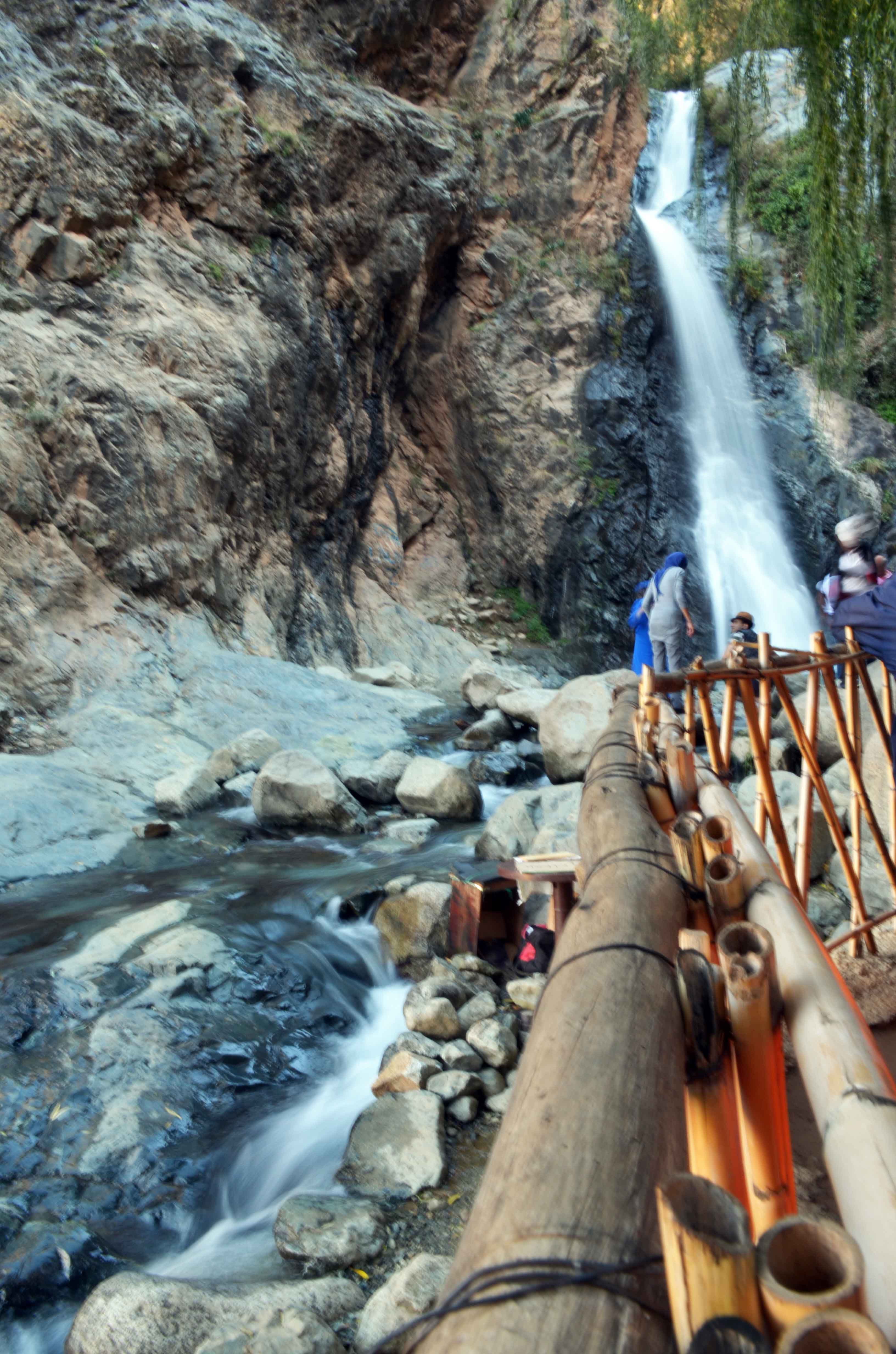
Landscape

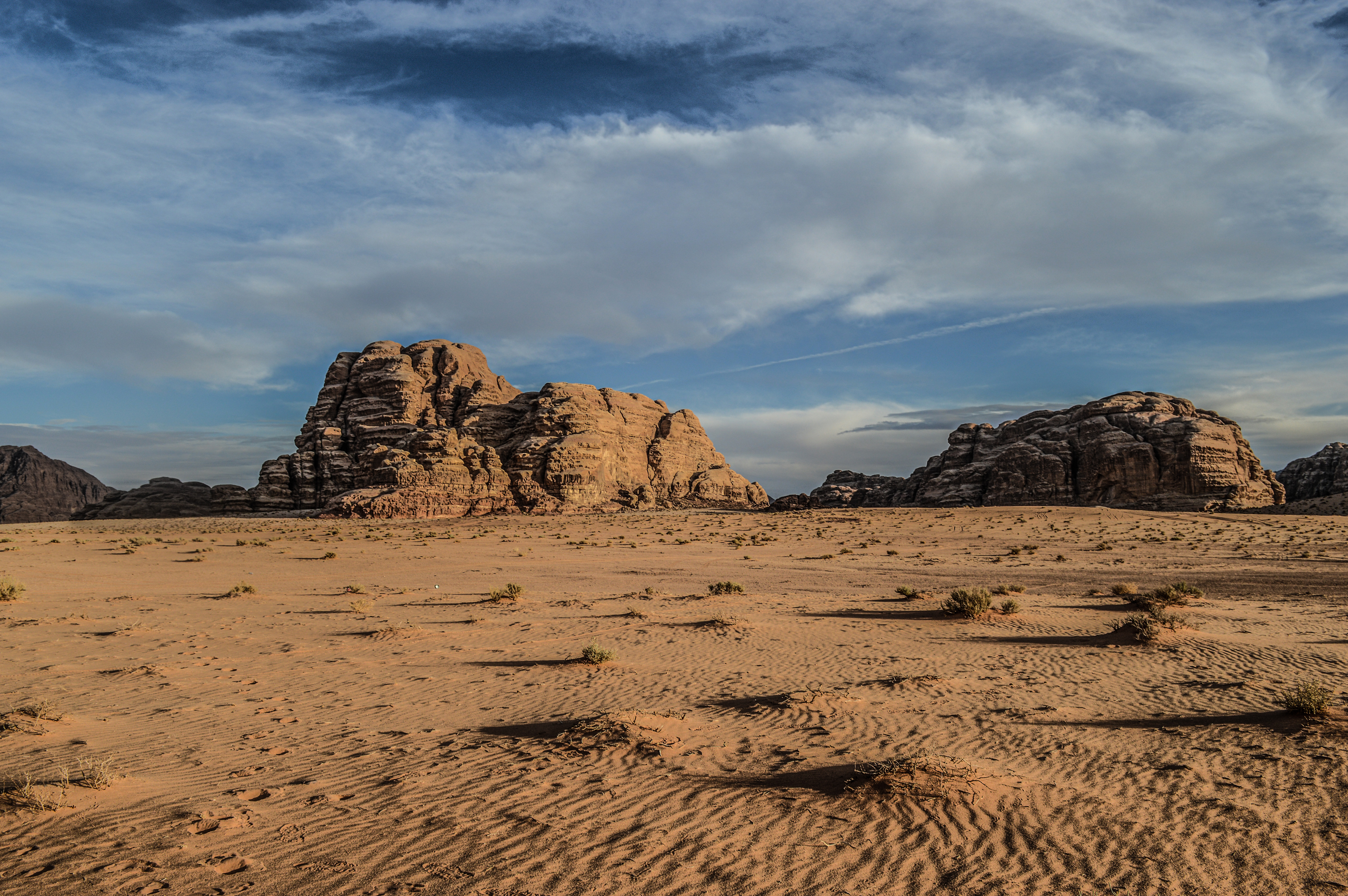
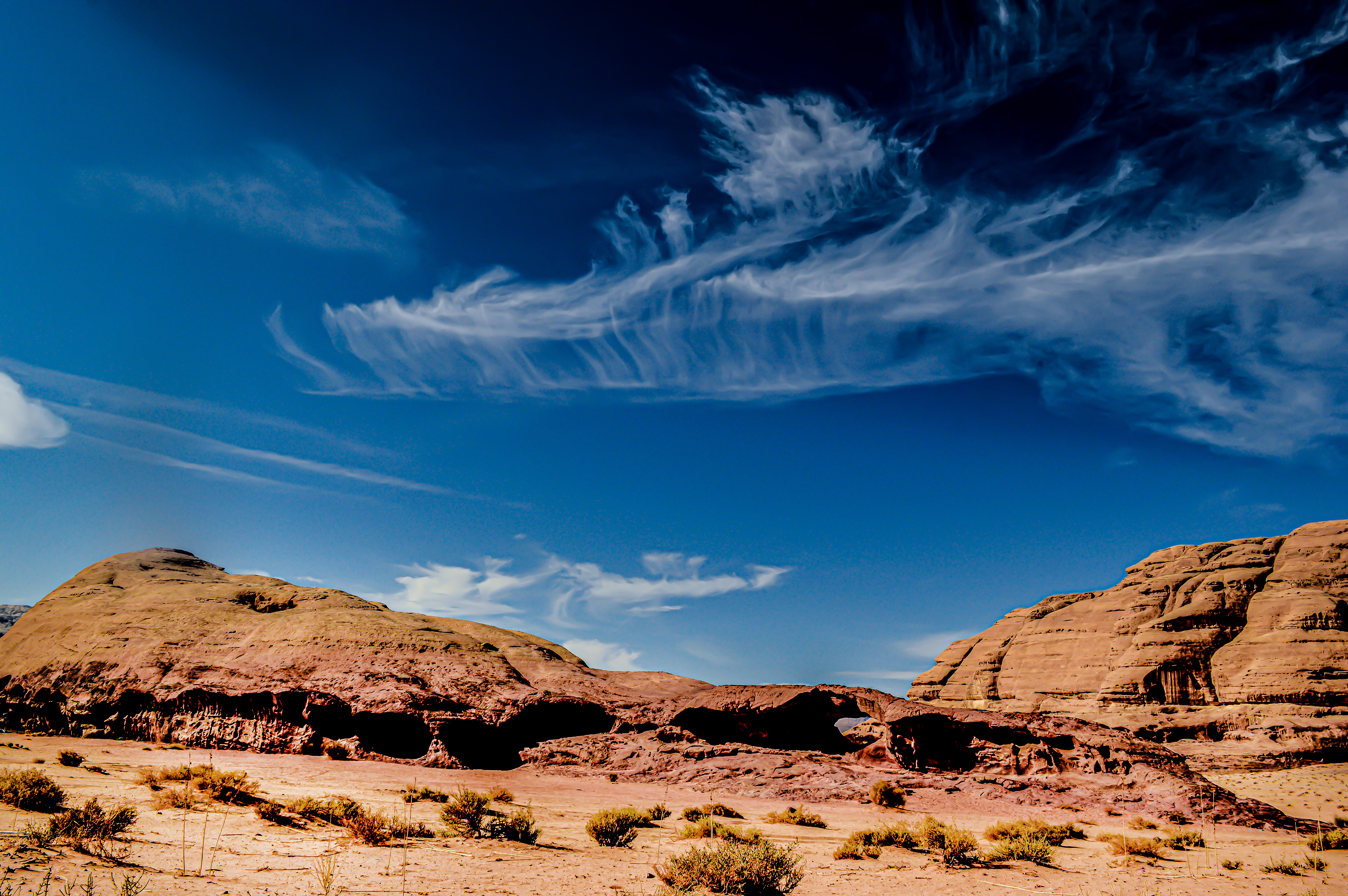
  El Salvador is the smallest country in Central America. It has 307 km of coastline along the Pacific Ocean and the Gulf of Fonseca, and it is situated between Honduras and Guatemala. The topography of El Salvador contain mainly mountains, but the country does have some narrow, relatively flat central plateau. The highest point in is Cerro el Pital at 2,730 m, and it is located in the northern part of the country, on the border with Honduras. Because El Salvador is located not far from the equator, its climate is tropical in nearly all areas, except for its higher elevations where the climate is considered more temperate. Lakes and volcanoes can be found in many areas too.

Rich range of a street food

  As a one of the poorest countries in Central America, gastronomy business creates some earning opportunities for many locals. You will just never get hungry in Salvador, as food stands are available on every single corner in every possible place. Vendors do offer a wide range of many meals from a very local snacks (pupusas – hand-made corn tortillas stuffed with various fillings such as beans; tamales-corn dough pockets that are served with different fillings like sweet corn, cheese, meat or dried fruits; pasteles-fried dough patties filled with meat like chicken, pork or beef and finely chopped vegetables; soups), along with more western options like chips (here eaten with mayo and cheese – see Germans, you’re not the only one:), burgers, pizzas; and finally finishing at any kind of shakes, natural fruit juices and many different sweets to pick. Any stomach will be satisfied in El Salvador.

Santa Ana Volcano

  One of the most amazing places I have seen in my life, definitely in my top five. For more info about volcano, and how to get there by public bus, please click here.
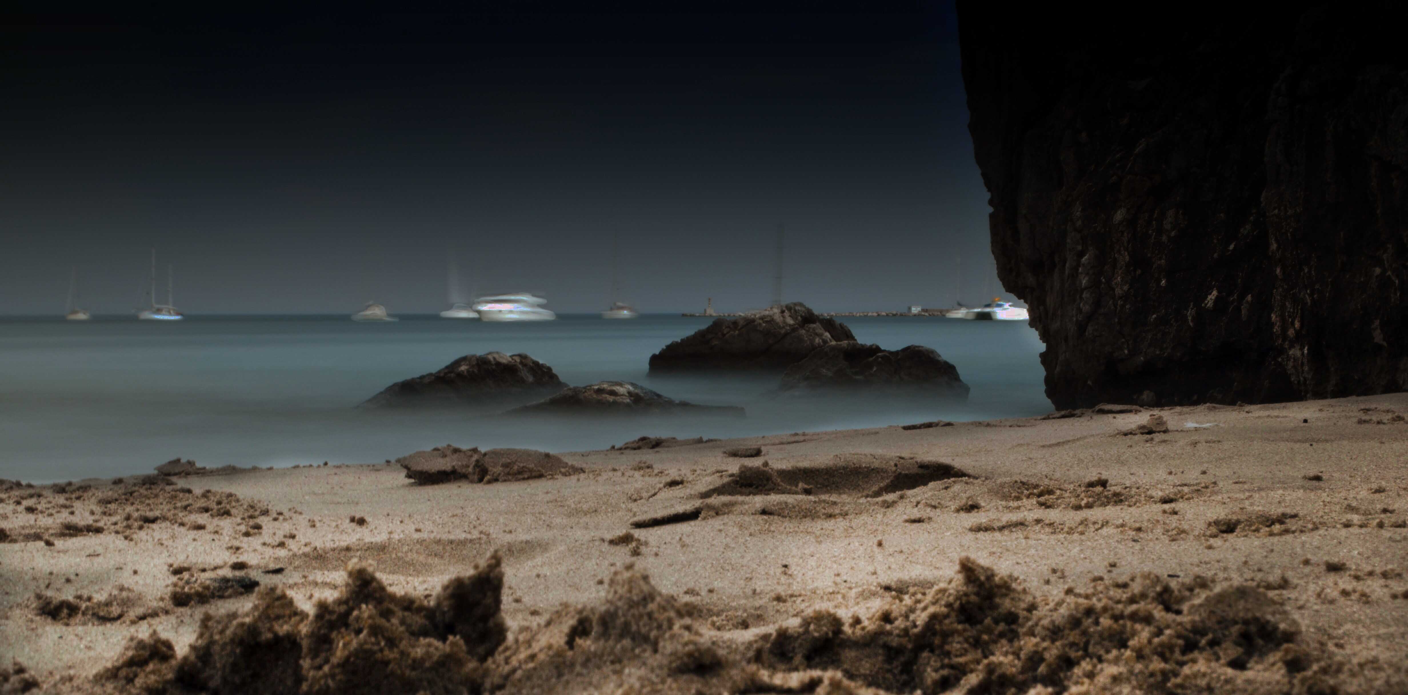
Cost line

  307 km of coastline along the Pacific Ocean contains a sandy beaches with beautiful tropical flora around. Coast is also well popular among surfers.

Cheap prices

 El Salvador is one of the cheapest countries in Central America. You can travel on public transport in the cities for maximum of 0.25$. The bus from capital to Santa Ana (2h of journey) cost as little as 1$. Hotel`s bed with bathroom can be found from 10$. Breakfast or lunch found on the street from 1$. Good place to buy some clothes at a very low price.

Just remember to

  Please note, if you are planning on going to El Salvador, do some research on area you will be staying in. Most of them are just fine, but few are controlled completely by gangs and nobody can access them. Police is not welcome there, if a solo officer will go to that part of the town, he will get instantly killed.

  Never walk after dark and try to avoid not crowded areas. Do not flash with your valuables like phone or camera, as thieving is very common generally in whole Latin America. Eh, that’s the reason I don’t have many photos from there.

Understanding a daily life in San Salvador

  But please do understand that people of El Salvador struggle on a daily basis. As much as  part “what I loved most” of this blog can sound as a fairy tale, we have to recognize that people of this country are in constant fear of being murdered or abuse in any way, especially young males. Here, I have to add that you as a tourist are very safe, way safer than locals. They are just not as fortunate as you are. Again, poorest people, like everywhere, are at greatest disadvantage that are forced to live in roughest areas where violence occur on a daily basis. A large percentage of the population lives under the poverty level, which means their chance for a decent standard of living is low. Their situation is so bad that many of them risk a dangerous trip up to the United States to look for better opportunities.

  Every private business have to pay a tax to one of the gangs that control the area or street. It is normal to see a dead body on the road sometimes, and that almost every shop got his own bodyguard with a shotgun, rifle or machine gun. Guns are visible pretty much everywhere, and are normal even for children. In western countries you can see a non-smoking signs, when in El Salvador no-gun sights are everywhere. Some people are forced to travel at night, which is a very dangerous thing. Many have witnessed a murder or are accused of snitching to authorities, while others have been evicted by criminals who wanted their home. Those with money or relatives in safer areas often seek refuge within El Salvador. Young girls tend to get pregnant at a very young age, just to avoid being claim by the gang members. It is well know that police and government is highly corrupted. Having said that, being a part of a force, is probably the most dangerous job to do as of war between gangs and the government. Fear is notable almost everywhere, buses are full of holes from bullets. Gang members are on every street, patrolling their territory, making sure money are collected from  business owners, and the collectors are usually under 12 years old.

  So this is a daily life in El Salvador, the country I felt in love with. As much as I hope to visit again, I would love to see the improvement on many levels, especially in crime rate and economy. Yet again, please note that this is one of the most amazing countries in the world. With a proper attitude you will be just fine, and you will experience and appreciate the people and the land, like I did.